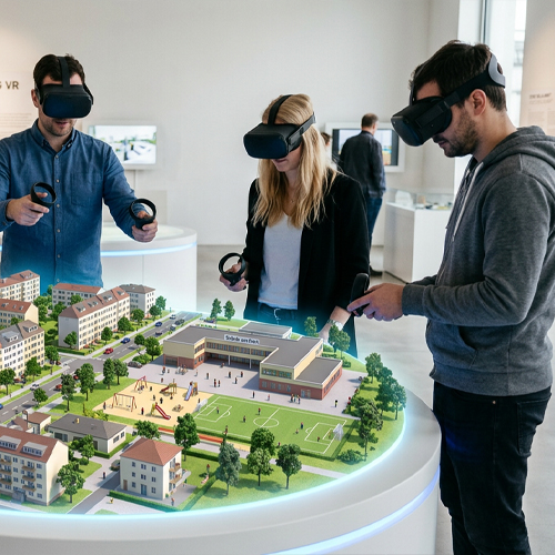

Cityplanning XR
CityPlanningXR is a digital tool that uses extended reality (XR) – that is, virtual and augmented reality – to present construction and urban planning projects in a vivid and immersive way. Instead of relying on difficult-to-understand plans, users can experience projects directly in the space, explore them intuitively, and better understand them.
Close up
A central goal of the project is to rethink citizen participation. Users can navigate future construction projects on their own and provide feedback directly within the application—simply, intuitively, and without any detours.
Not only does this ensure greater transparency, but it also helps reduce misunderstandings. After all, when people can experience a project spatially, they grasp the connections, dimensions, and potential impacts more quickly.
The goal is to make democratic citizen participation simpler, more accessible, and more transparent. Information, interaction, and feedback are consolidated into a single application so that all data can be used as easily as possible. AI-powered features help efficiently analyze and summarize this feedback without distorting the content.
But experts and decision-makers also benefit from the clearer presentation of planning statuses, enabling them to coordinate efforts more efficiently.
Pilot Project
The City of Leipzig is participating in our project and providing us with an initial use case. Specifically, this involves the new “Heiterblick-Süd” district in the east of Leipzig. The idea is to combine new housing with green spaces and social infrastructure to ensure sustainable and forward-looking neighborhood development.
The city is providing us with planning and inventory data, including 3D data, and supports us with regular updates on the current planning status. In addition, it is actively involved in the requirements analysis and software testing, contributing its expertise in urban planning processes. The city is also involved—as much as possible—in future public relations efforts and helps integrate the application effectively into existing structures and processes.
Teamwork
CityPlanningXR is a research project scheduled to run for approximately two years and is part of the XR Interaction Network. Together with our partners, we aim to develop a scalable solution that can be used in public and private planning processes over the long term.
Our consortium partners are:
- compl3te GmbH,
- TU Chemnitz,
- Hochschule Mittweida,
- Stadtplanungsamt Chemnitz,
- Innovationsnetzwerk XR-INTERACTION
The project is funded by the Sächsische Aufbaubank (SAB), the European Union, and the Free State of Saxony.
Thumbnail created with Adobe Firefly